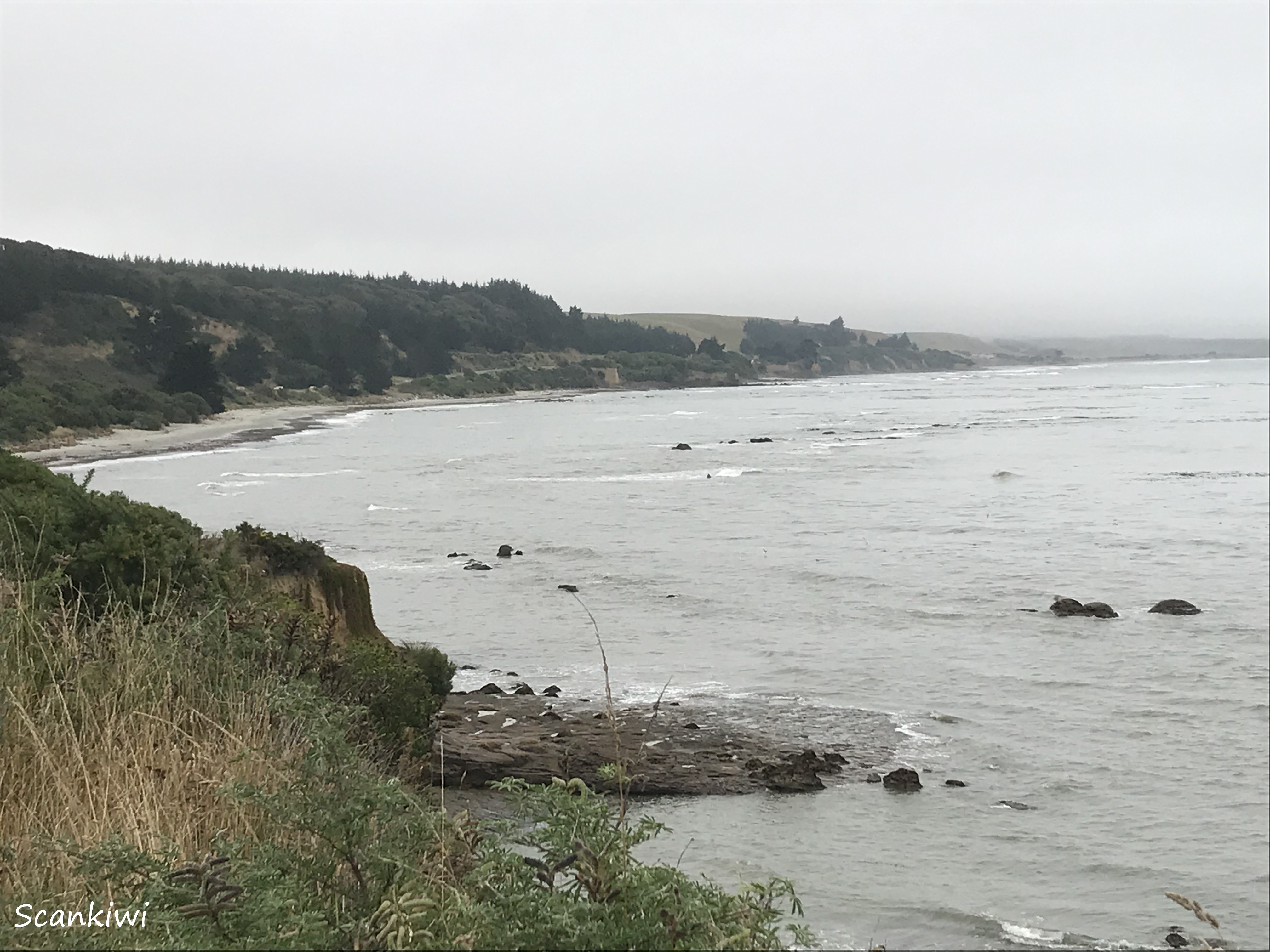
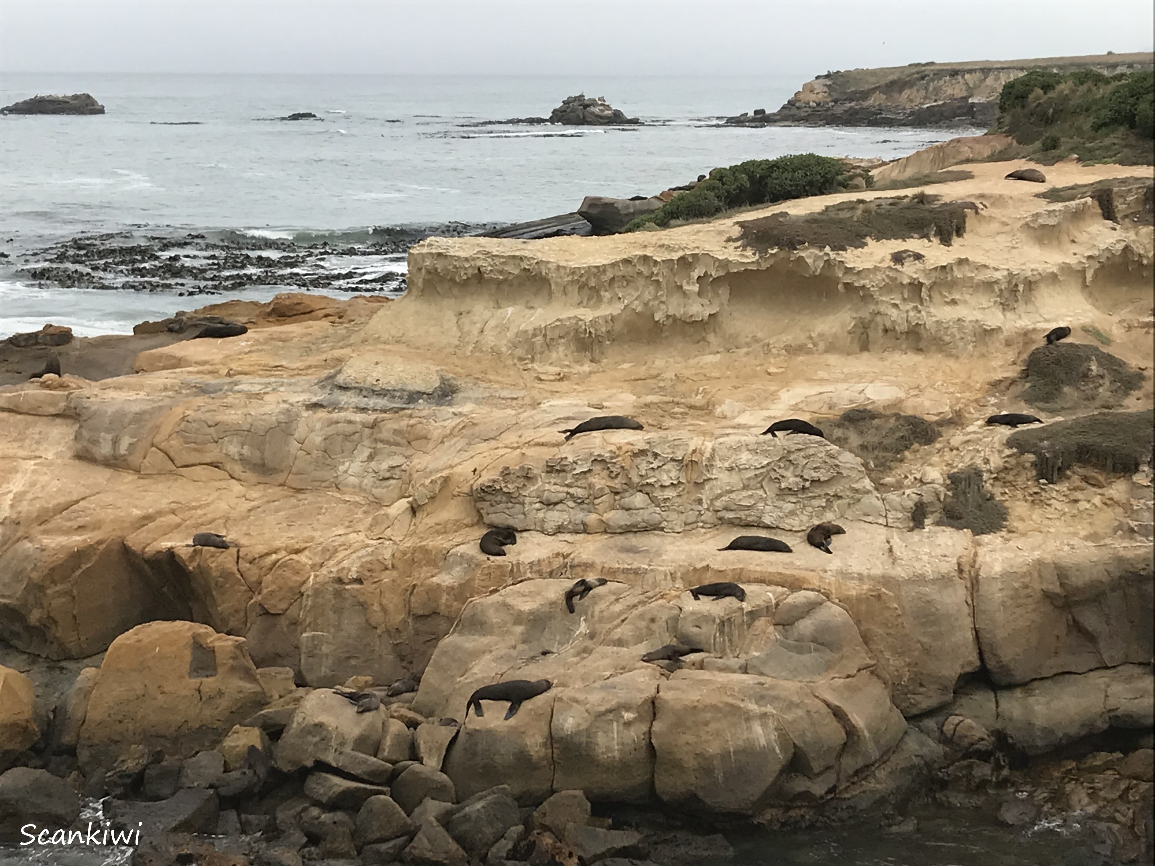
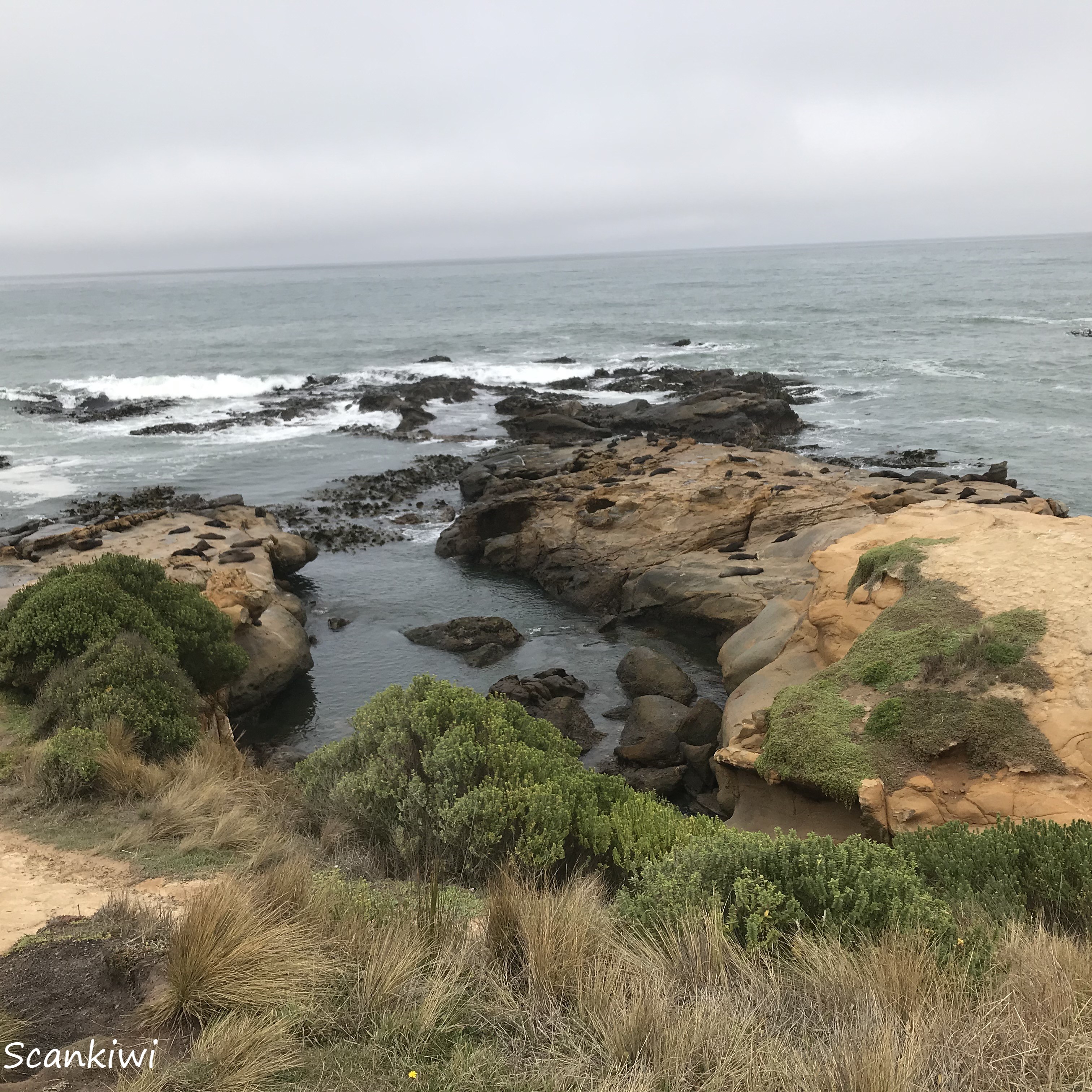
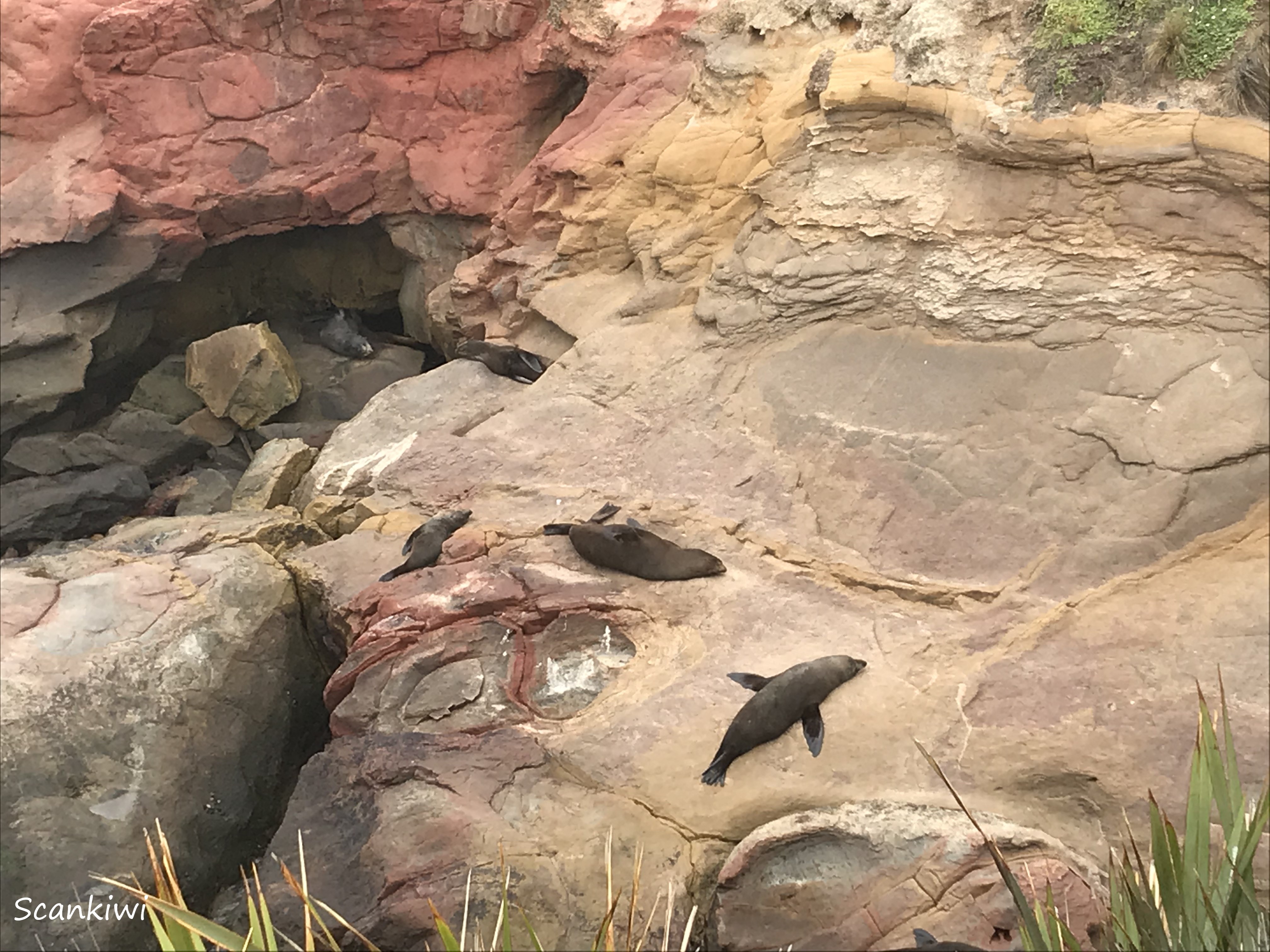
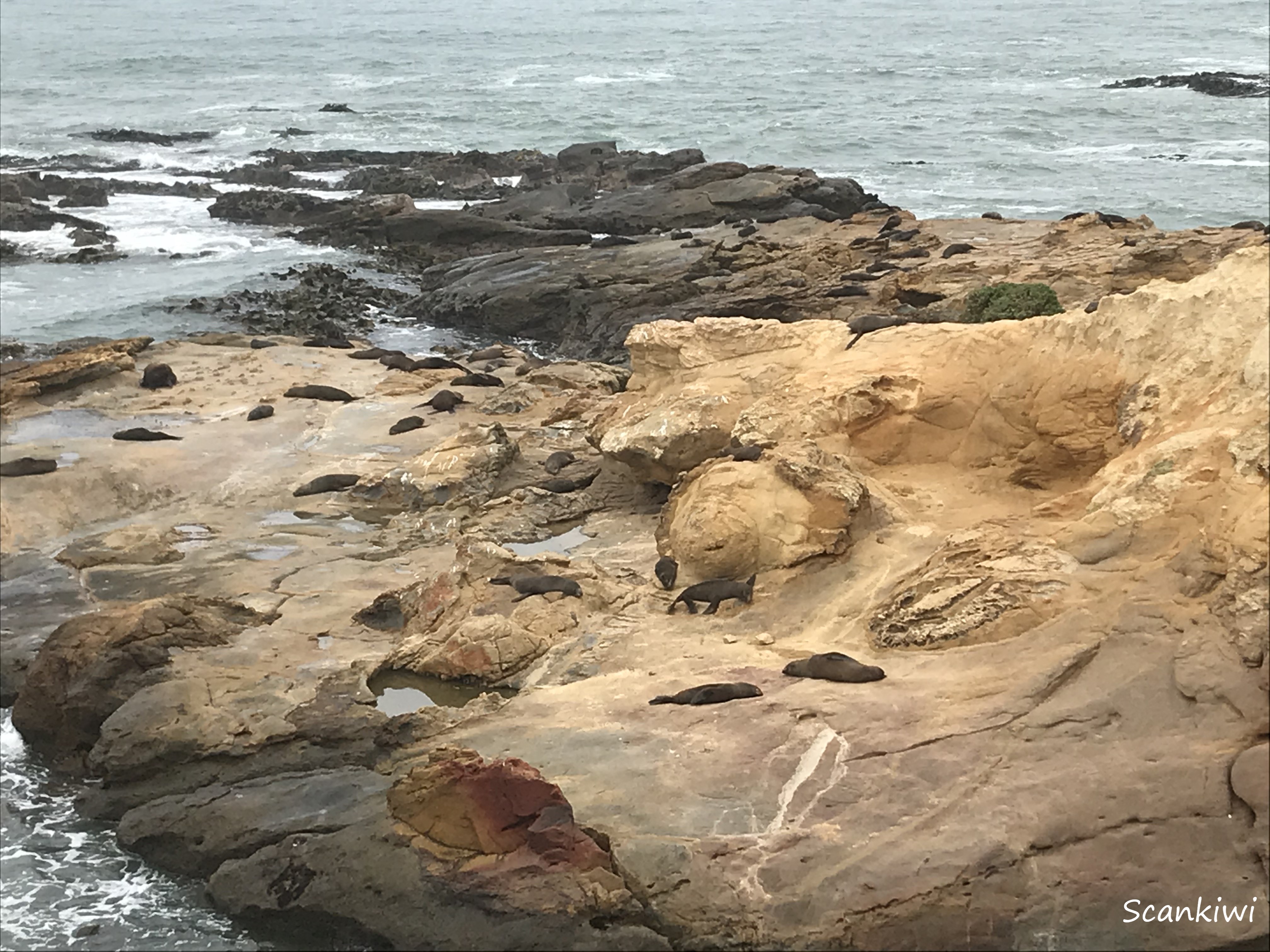
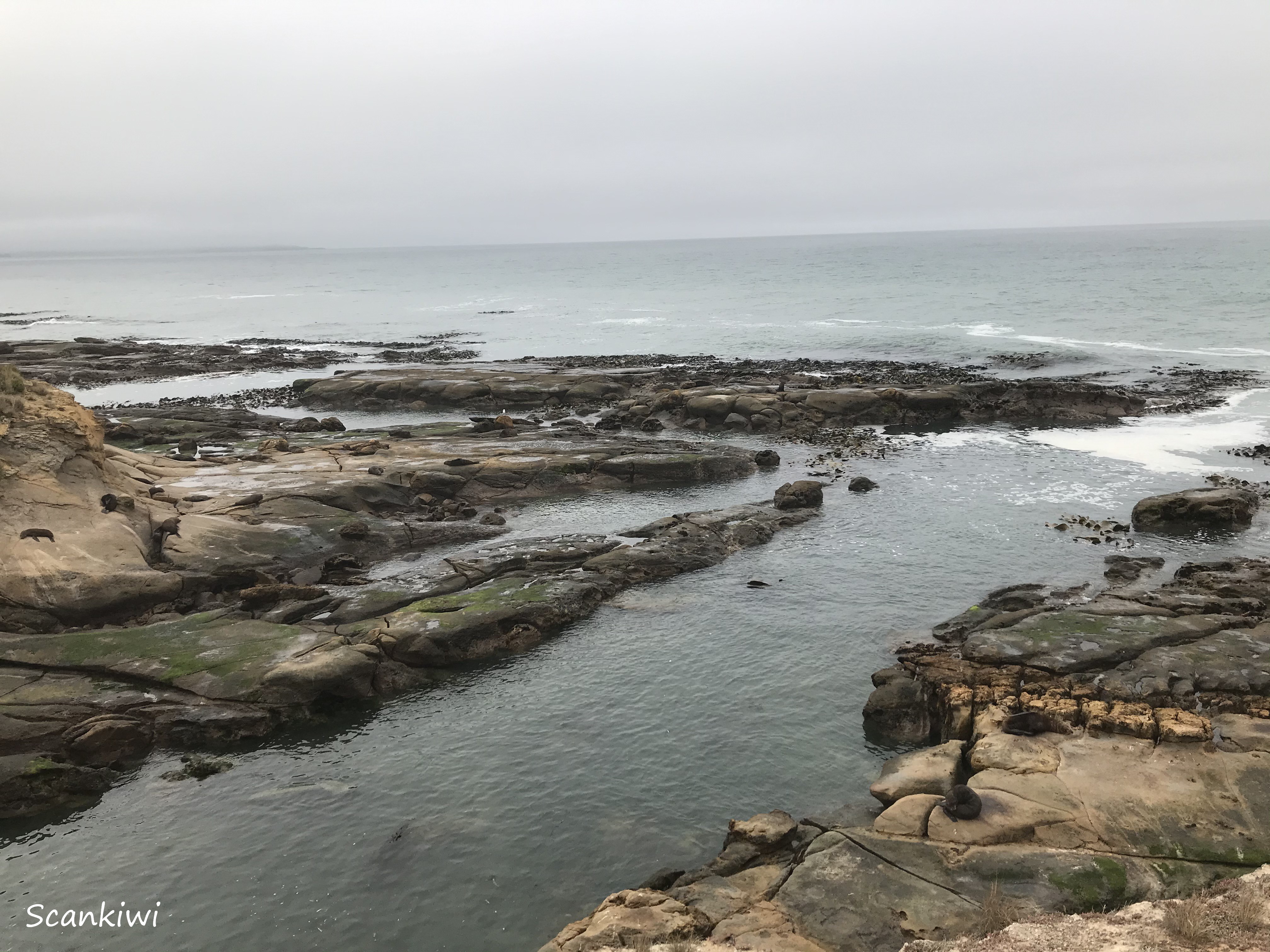
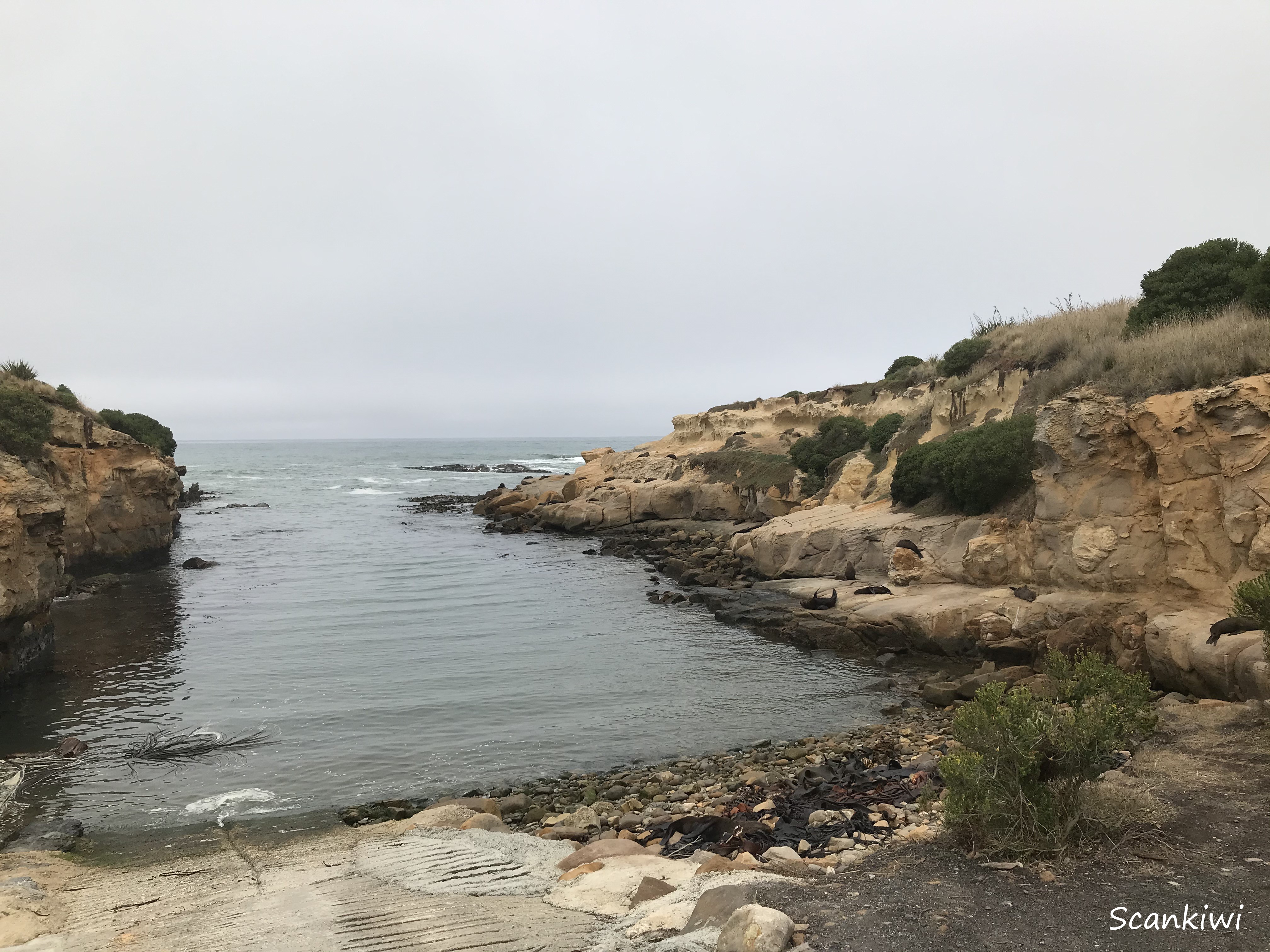
My journey continued northward from Dunedin along the east coast of the South Island to visit my life long friend Dave in the town of Oamaru. The 112 km drive along the East Coast is dramatic through rugged hills over the Kilmog and along the rough coastline bounding the Southern ocean giving spectacular and dramatic views. The weather wasn’t the greatest to show the coast at its best but that is the temperament of the Southern ocean. I made a stop at Shag Point to have lunch and enjoy one of MacGregor’s famous mutton pies (a legend in these parts) while visiting the fur seal colony. The seal colony is magnificent and can be observed from the cliff tops giving you great views without disturbing the seals. I have been fishing at sea with my brother here. We used to launch his boat here (see the last picture before the pie). It was always a skill to catch the waves correctly going out and especially when returning when the swell could rise and fall 3-4 metres between the rocks.


The town of Oamaru is nestled in the hills south of the mouth of the mighty Waitaki River. It is a moderately large but rather sleepy town servicing the rural community in the hinterland. It was once a bustling port exporting frozen lamb all over the world but when the port closed it retired into itself. The technique of exporting frozen sheep meat was developed south of Oamaru on the Totara Estate leading to the use of the new steam-powered freezing technology to send meat to the other side of the world. This lead to the first ever shipment of frozen mutton from New Zealand to England was in 1882 from Oamaru (a three-month journey) launching an industry that lead to New Zealand’s prosperity.


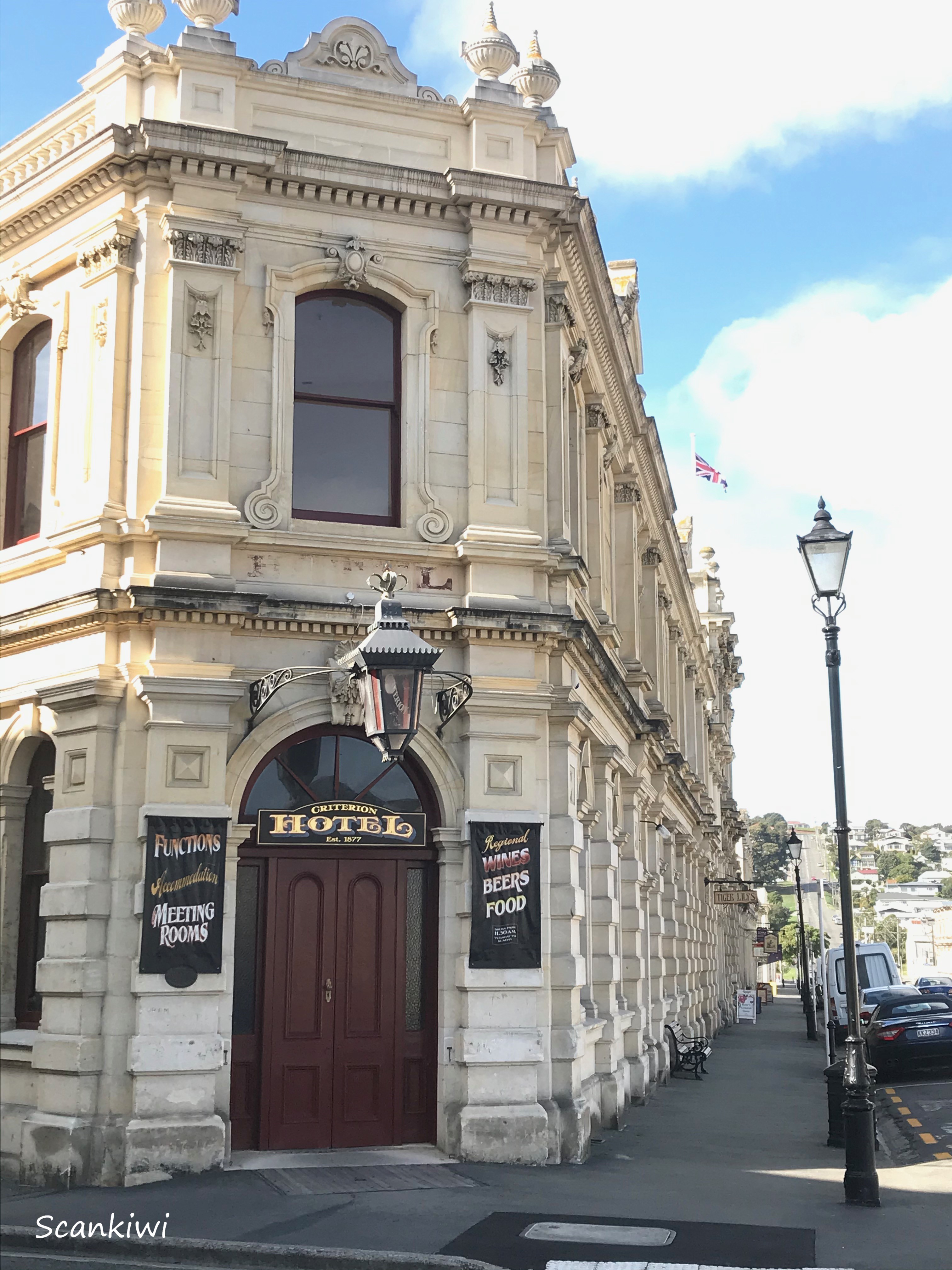
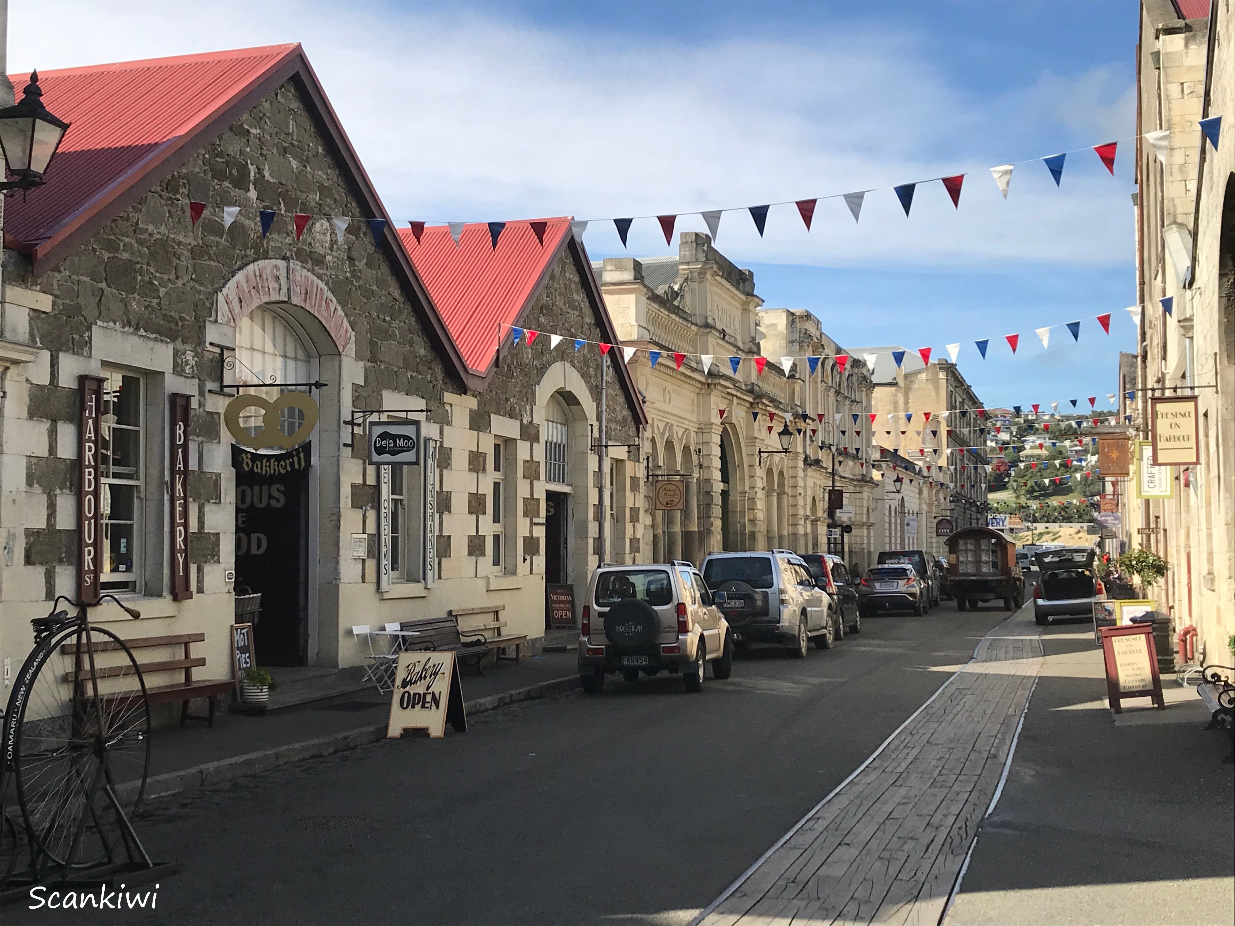
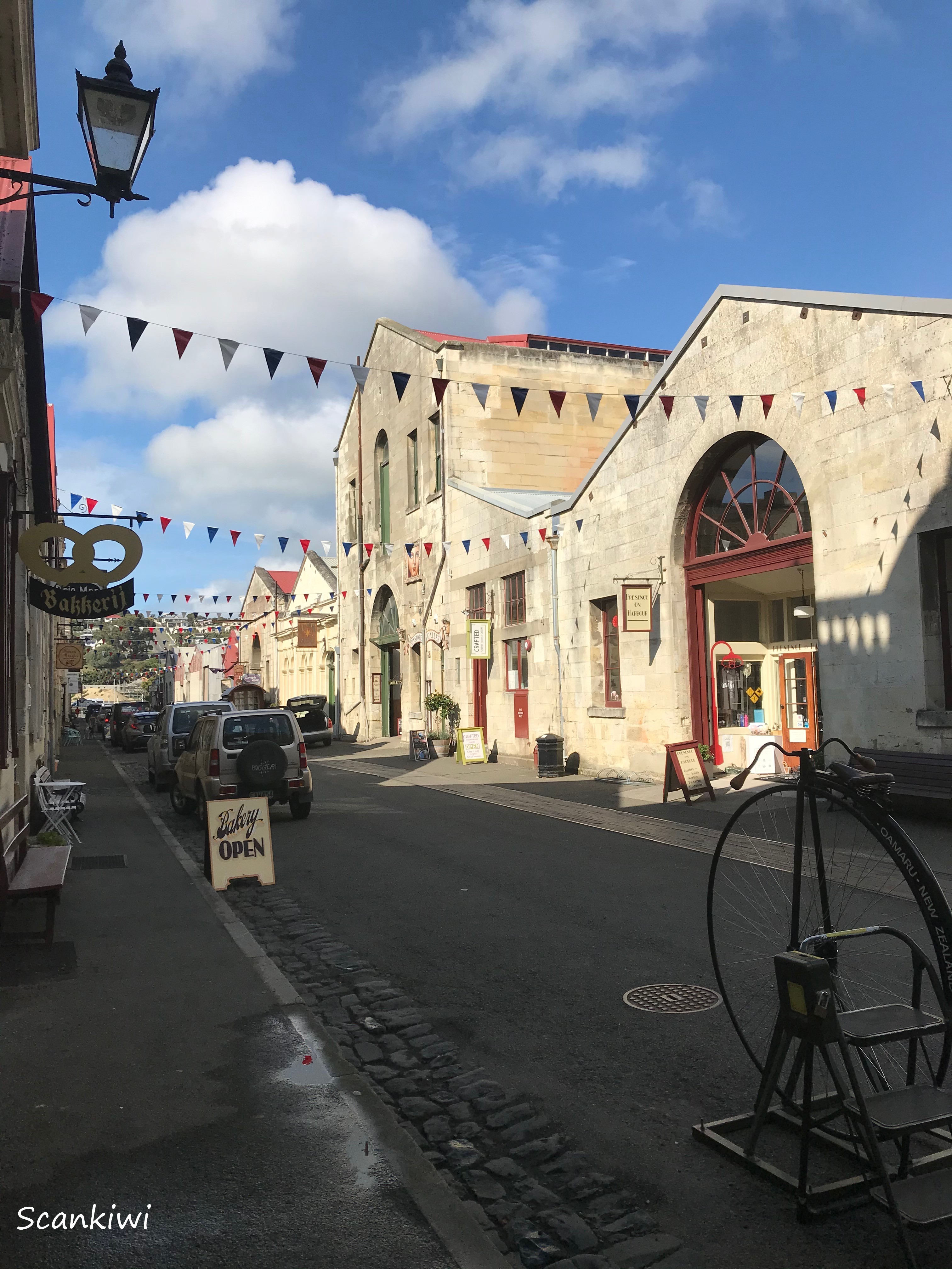
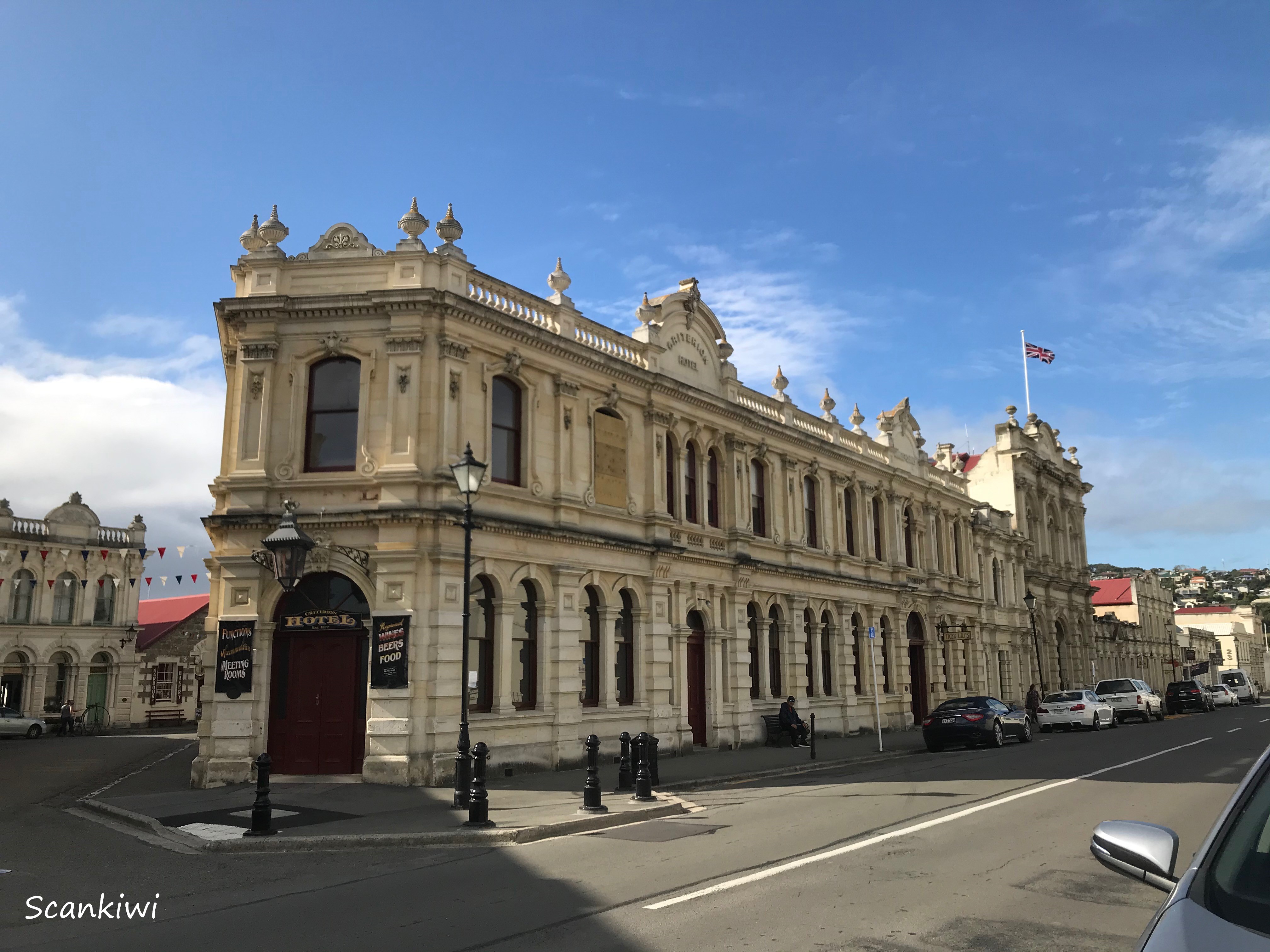
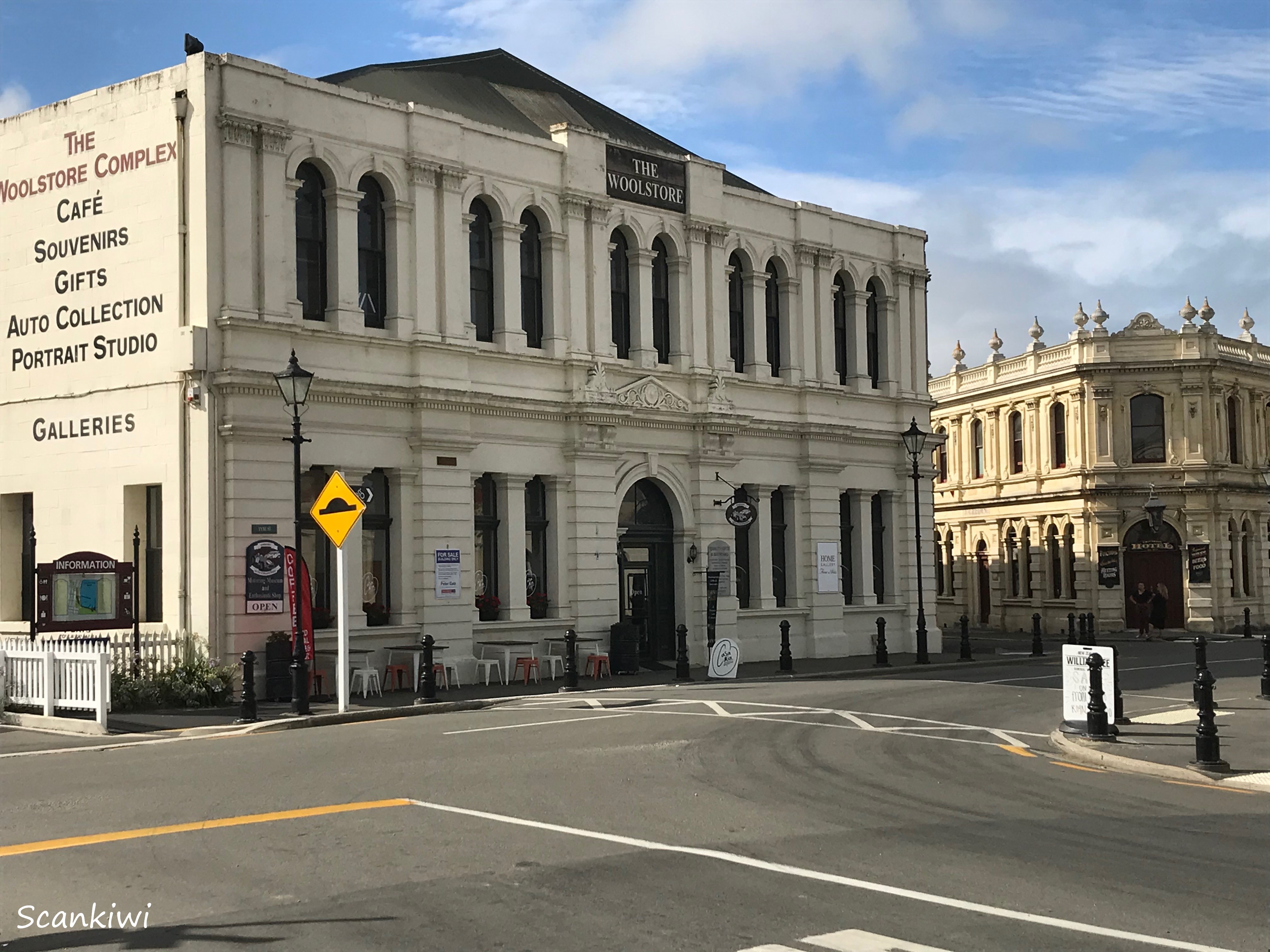
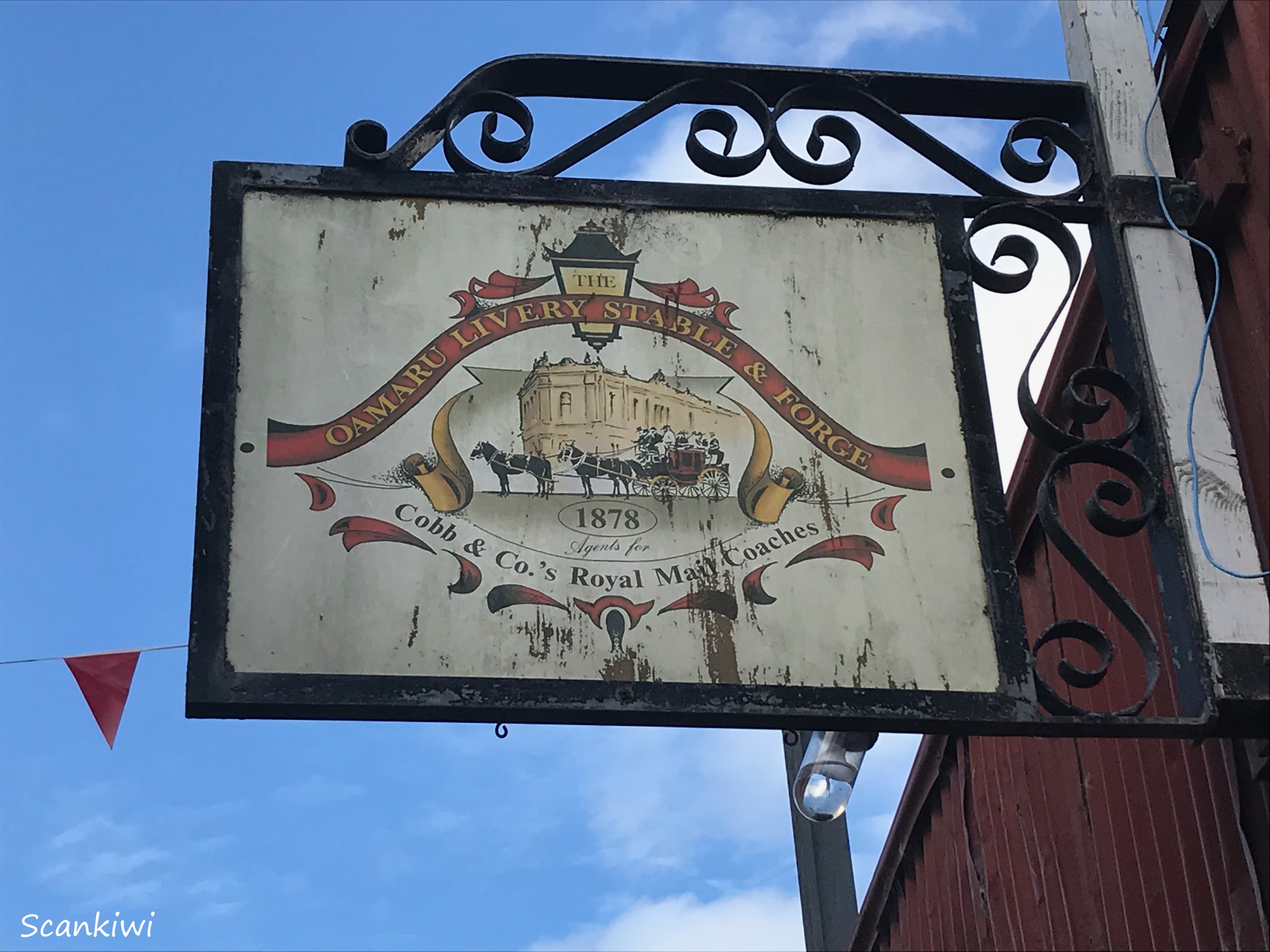
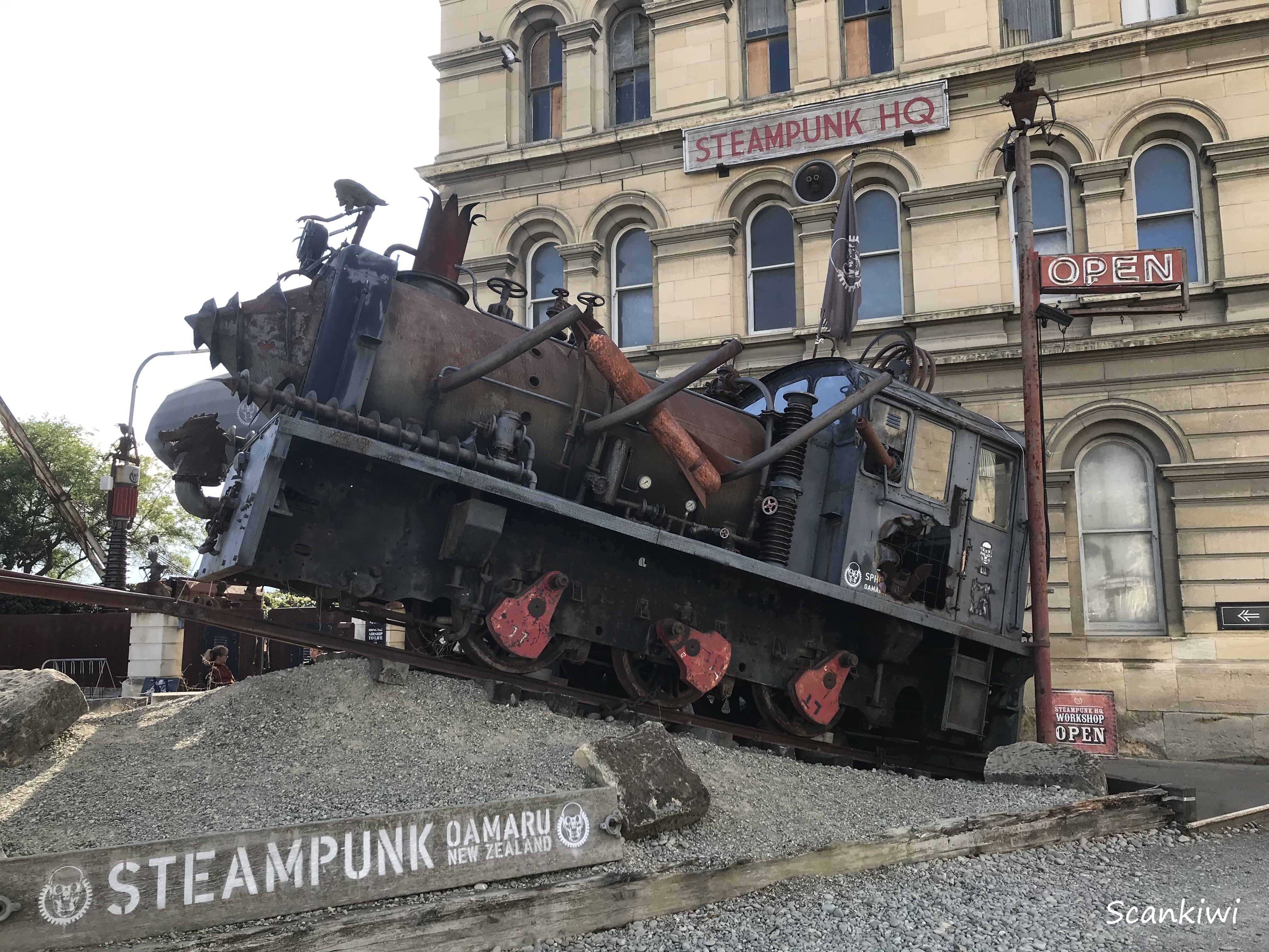
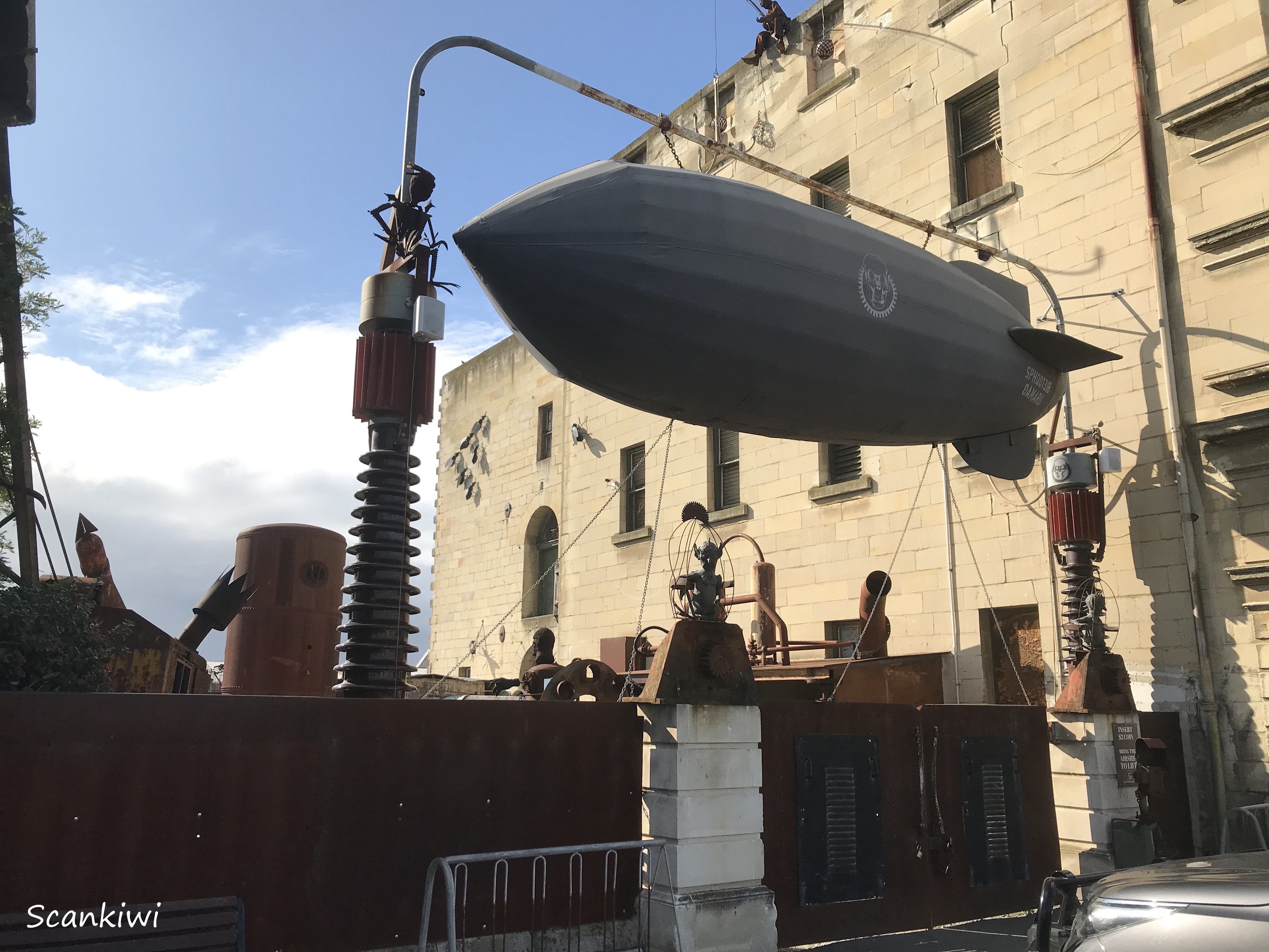
The town is probably better known now for it fantastic limestone Victorian architecture and its strong association with the arts and sports. Many public buildings are constructed of the local creamy white limestone known as Oamaru stone. The Victorian precinct in southern part of Oamaru is one of New Zealand’s most impressive streetscapes due to the fact that many of these prominent 19th century buildings constructed from this material are preserved. The Victorian theme has been embraced by local shops and galleries in this part of Oamaru further enhancing the feel of times of an era gone by. Many of the buildings in this area close to the harbour used to serve as commercial warehouses and stores and now provide large spaces for galleries such as the Forrester Gallery, the Grainstore Gallery, The Libratory and Steampunk HQ. In August 2016 Oamaru made it into the Guinness Book of World Records for the largest gathering of steampunks in the world, a term that was coined in the 1980s and is based on imagining inventions the Victorians might have created for the modern world.

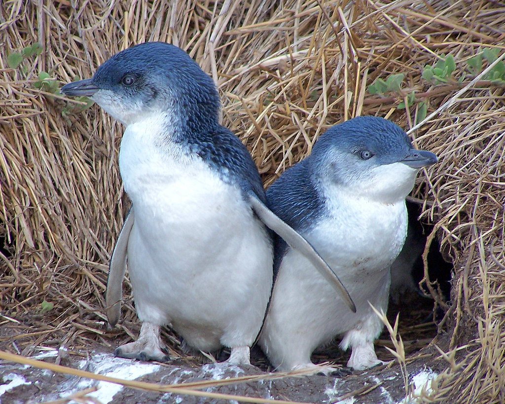
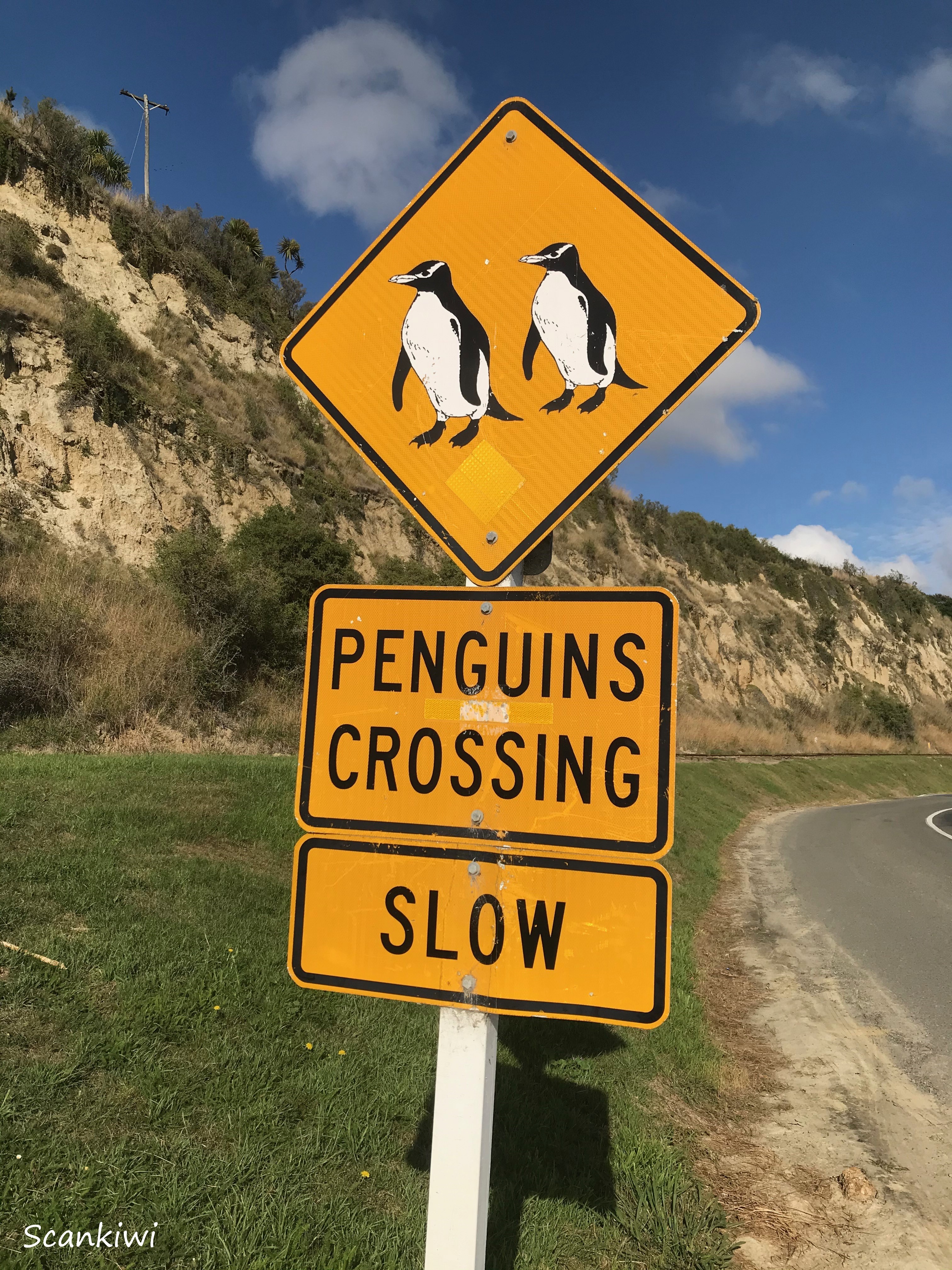
Further around the harbour from the Victorian precinct is a colony of little Blue Penguins, right in the middle of town. The Little Blues or sometimes called Fairy penguins, grow to no more than about 30-35 cm tall. They live in underground burrows in the clay cliffs and can be observed leaving in the morning to spend the day at sea feeding before returning at dusk on mass to their burrows for the night. Often a Sea lion can be found lurking around nearby to try and grab a meal as they leave the water and lose the agility & mobility they had in the water.
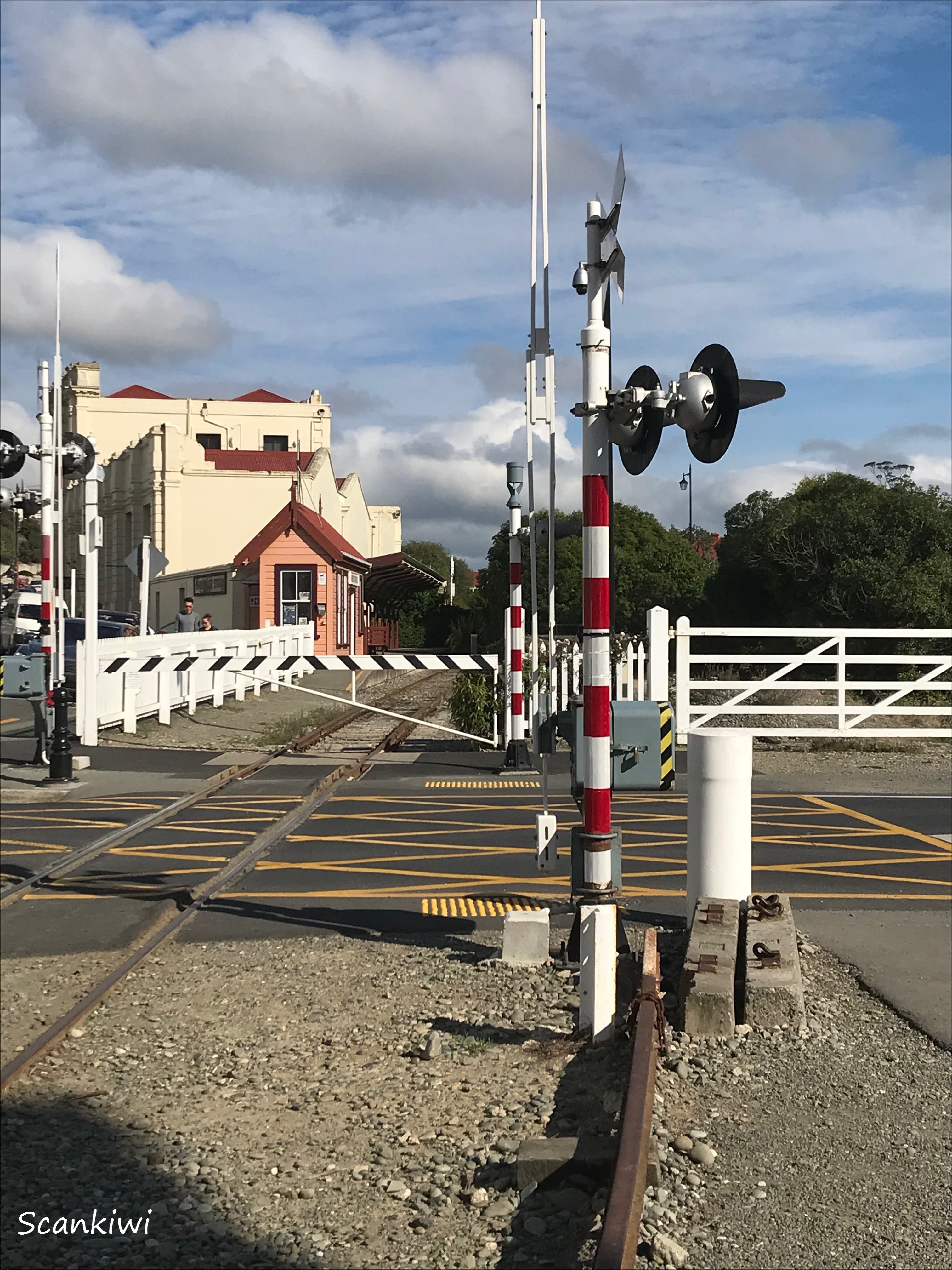
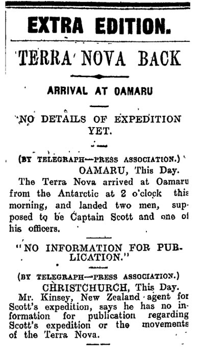
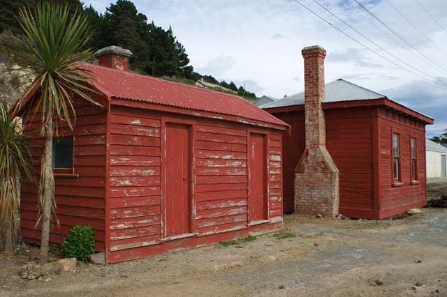
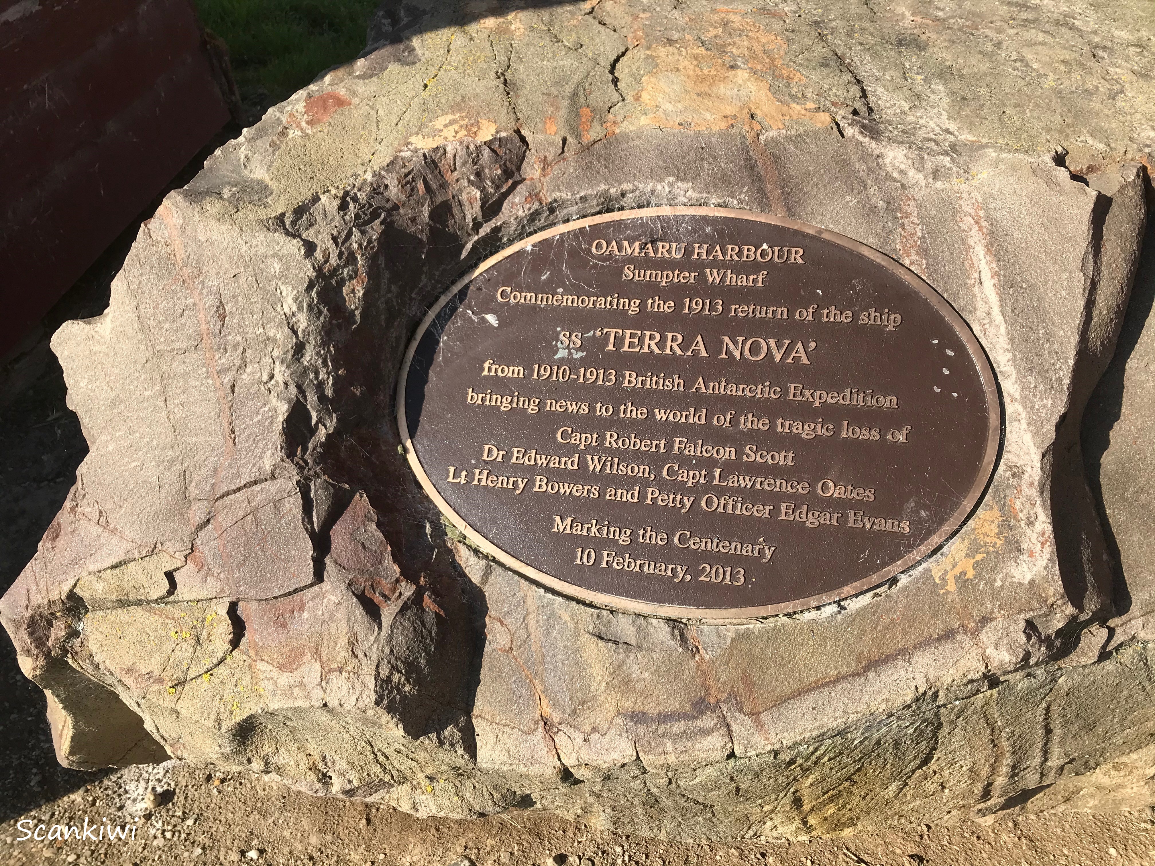
Beside the penguin colony is a collection of small red wooden buildings which have an unknown historic significance. They are the old Harbour Master’s hut and telegraph buildings at the end of Sumpter wharf. In the early hours of the morning of the 10th of February 1913, a ship (the Terra Nova) arrived and refused to identify itself. Two officers were rowed ashore and then the ship mysteriously left. The two officers then sent a coded message by telegraph and subsequently left by train for Christchurch to catch up with their ship again. That coded message was sent across the world to London and informed the world of the death of Robert Falcon Scott and the members of his team on their ill-fated expedition to the South Pole.


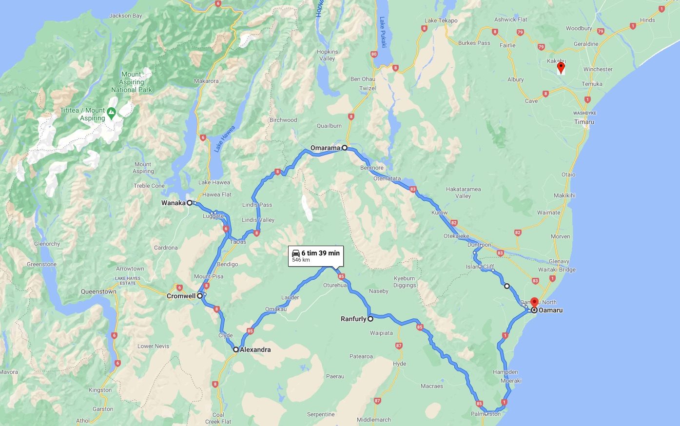
One of the days while staying in Oamaru, Dave & I decided to take a road trip through to Central Otago where we both had lived at one time or another. Along the mighty Waitaki River Valley to Omarama and from there over the Lindis Pass to Lake Wanaka for lunch. The on to Cromwell where my family had lived, to Alexandra where Dave had lived, then through the Maniototo via Ranfurly back to Oamaru. A round trip of 550 km.
the first stop was at the famed Elephant Rocks near Duntroon. The are a collection of large weathered limestone rocks. The rocks themselves are rounded and pockmarked from weathering, but do not specifically resemble elephants. The Elephant Rocks area was used as a film location for the first Chronicles of Narnia movie in 2005 when it was transformed into Aslan’s camp.
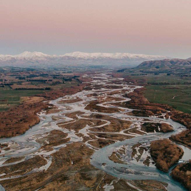
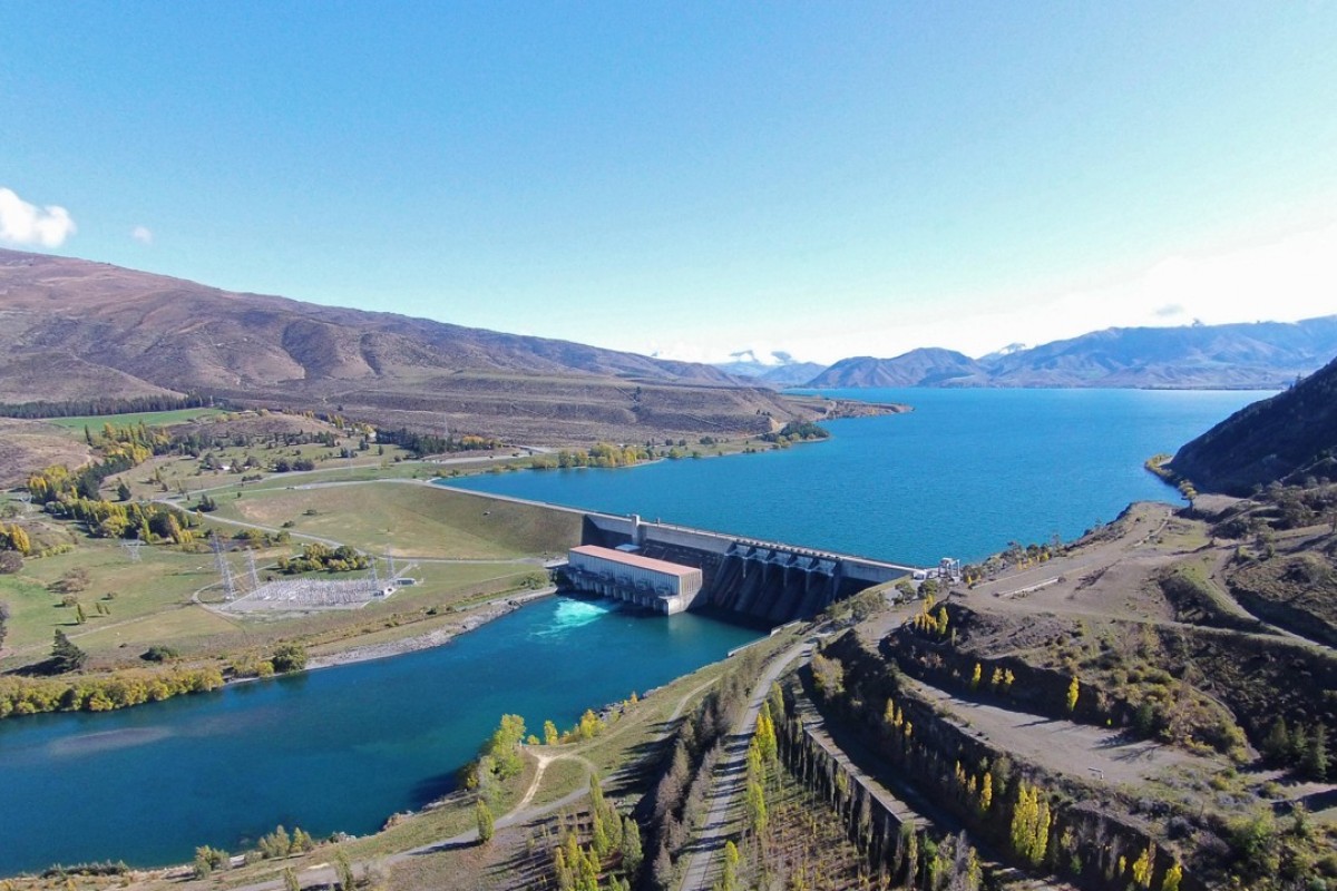
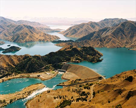
The trip continued up the Waitaki River, one the South Island’s large braided rivers that runs some 110 kilometres from the Southern Alps to the Pacific Ocean. It starts at the confluence of the Ohau River and the Tekapo River in the MacKenzie Basin. These rivers are fed by three large glacial lakes, Pukaki, Tekapo, and Ohau. At the head of Lake Pukaki is NZ’s highest mountain Mt. Cook/Aorangi (see my previous post). At the beginning of the 20th century the first of a series of 8 hydroelectric dams was built (Waitaki) and the last in the 1985 (Ohau B & C). The Waitaki flows through Lake Benmore, Lake Aviemore and Lake Waitaki, these lakes being created behind the hydroelectric dams of the same names before entering the Pacific Ocean. The lakes and river are supplied by water fron the melting snow of the Southern Alps which form the backbone of the South Island. The Waitaki hyrdorelctric power schemes is one of the largest in New Zealand’s renewable energy supply however while being touted as environmentally friendly, it has not been without controversy and division of public opinion. Some have been lead to even write songs about it.
Song of the Waitaki (Plainsman – 1967)
Rippling waters of Waitaki sing your song of power to me
sing of tall distance mountains, Mackenzie lakes so free,
tell of how the men have tamed you, hear the turbines giant roar,
listen to your waters lapping in the penstocks at Benmore.

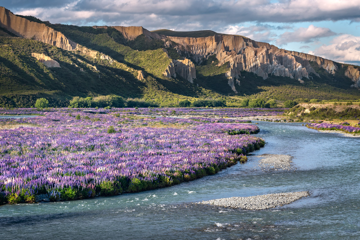
At the head of the Waitaki River you arrive in the South Canterbury town of Omarama (Māori for “Place of Light”, a reference to its extraordinarily pure and clear sky). It attracts anglers to the high country trout fishing, artists because of the exceptional light, astronomers due to the clear unpolluted night skies, skiers to the nearby Ohau skifield and sailplane enthusiasts (its world renowned hot air thermals that can keep sailplanes aloft for a whole day). I referred to this area and the spectacular clay cliffs briefly in an earlier post in 2013. From there we turn south to head over the Lindis pass (971 m) into the Clutha River Valley and to Lake Wanaka
Dave & I have spent many a summer and winter in Lake Wanaka. I spent part of my youth growing up in the town of Cromwell 30 km away and Dave’s parents owned a summer house here. The winter’s were spent on the skifields above the lake (Cardrona & Treble Cone) and the summers enjoying the holidays on the lake. The town has grown substantially since those hazy days of the 80s & 90s from a local holiday paradise to a national & international destination leading to tourist domination similar to Queenstown (probably a more budget orientated clientele). If you follow the shores of the lake westward you can access the West Coast of the South Island on the other side of the Southern Alps via the Haast Pass (562 m). After lunch the journey continued down the Clutha River Valley to Lake Dunstan and Cromwell, once my home town. Lake Dunstan was formed in the time I lived there by damming the Clutha River in the river gorge at Clyde behind a 100 metre dam about 15 km south of Cromwell. Cromwell is known to be one of the hottest and coldest spots in NZ. In the winter it can reach as low as -10 C with spectacular hoar frosts and in the summer can knock on nearly +40 C. The river valley where it lies is a high mountain desert with an average rainfall of about 40 cm a year, so regardless of what time of year it is relatively dry & sunny. The area was most notable for the major Central Otago Gold Rush of the 1860s with major strikes along several parts of the Clutha River including Cromwell. Methods of panning, sluicing and dredging have left their scars on the landscape until this day. Today, the gold produced in the town is stone & pip fruit (cherries, apricots, nectarines, peaches, apples & pears) and wine (Pinotage & Pinot Noir). Again the lake’s summer activities and the access to the nearby skifields have turn the town into a summer holiday centre and it bears little resemblance to how I remembered it, however the house we lived in still stands on Ortive street 50 meters from the lake shore.
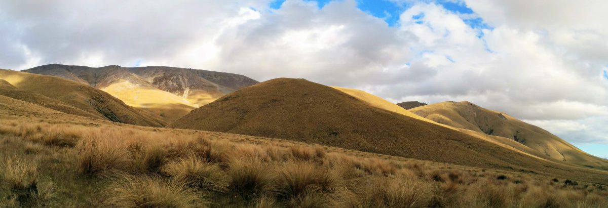
Our journey continued down the Clutha River to Alexandra at the other end of the Cromwell gorge and on the other side of the Clutha Dam. Alexandra too has its roots in the gold rush and today is the largest service town in the area. Having a similar climate to Cromwell, it has the same horticultural based industries of fruit and wine and a similar attraction to holiday makers but perhaps more of the homegrown type. From there we turned north into the Maniototo, an elevated inland plains region at the head of the Taieri and the Manuherikia rivers bounded by the Kakanui Range to the north and the Rock and Pillar Range to the southeast. It is a sparsely populated, harsh, desolate & dry tussock grassland region with spectacular rocky outcrops. The scenery between Omakau and Ranfurly appeared in Peter Jackson’s The Lord of the Rings film trilogy as the location for many of the scenes set in Rohan. During the 1860s the region was also another of the sites for the Central Otago gold rush. Sheep farming is the major source of income for the area today. The area is closely associated with the sport of curling with irrigation dams freezing solid in the winter providing natural outdoor curling rinks and here is the only natural luge track in the Southern Hemisphere.
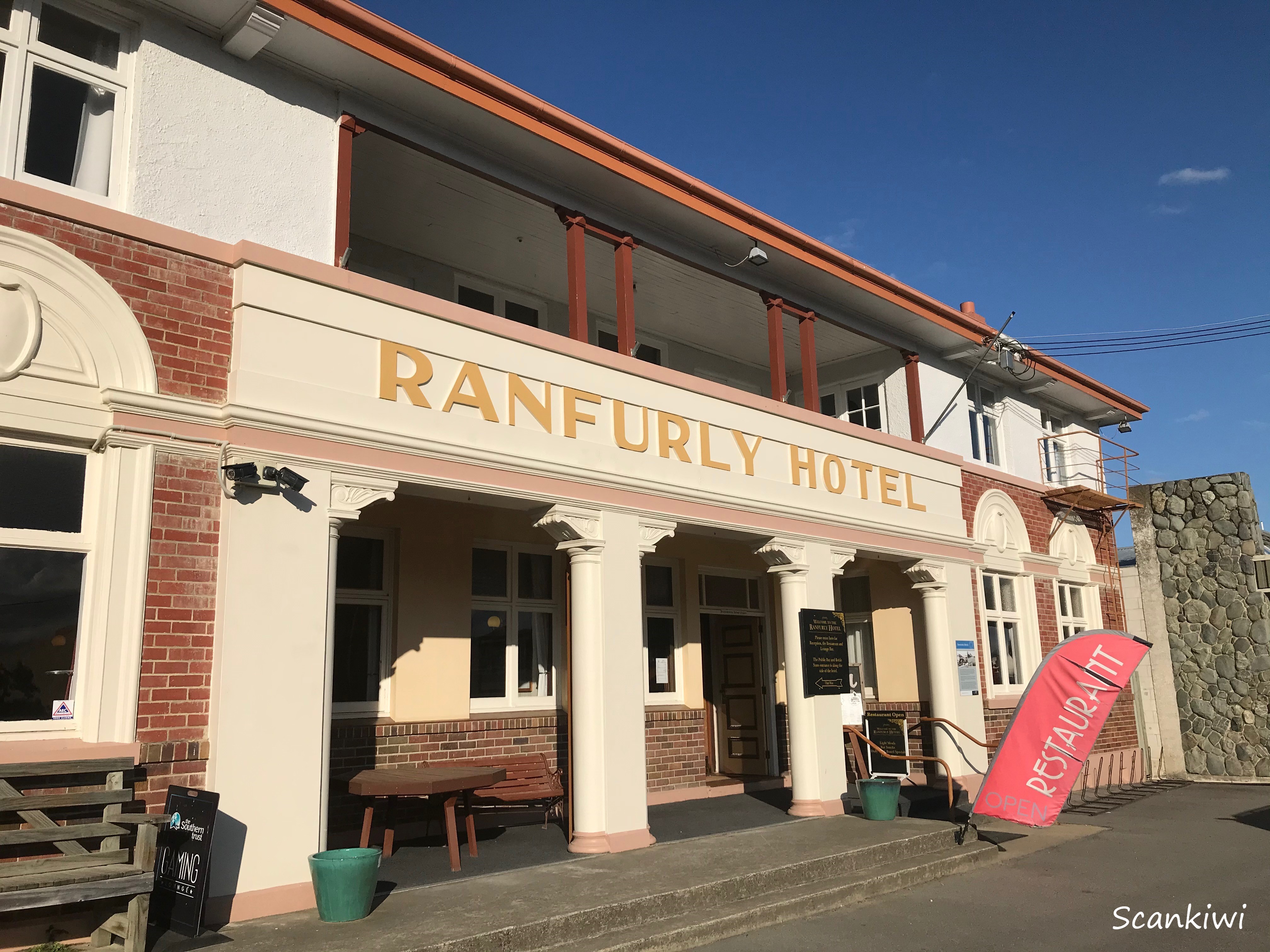
The last stop on our road trip before heading back to Oamaru was in Ranfurly at the pub/hotel for dinner. While quenching a thirst with a cold beer and refueling on some “pub grub”, a memory from 1988 was brought back into cold clarity of having spent a night in the hotel after an accident at the top of the Wedderburn. A mini van we were traveling in on a ski trip to Wanaka slid off the road in horrible ice conditions during the evening leaving us stranded in the hotel until morning when we could assess the damage and return to Dunedin. No one was injured but it gave us all a fright. Anyway, after adequate refueling and a warm summer evening we hit the road for the remaining 1.5 hours back to Oamaru. A trip down memory lane to the both of us.
A few days later I said farewells and headed north to visit a old Swedish relative in Timaru, family in Ashburton & Methven, aviation history in Temuka before flying out of Christchurch to the North Island. All in the next post.